
LiDAR Analyzer. Automatically identify every vegetation clearance distance by building a rich model of your network.
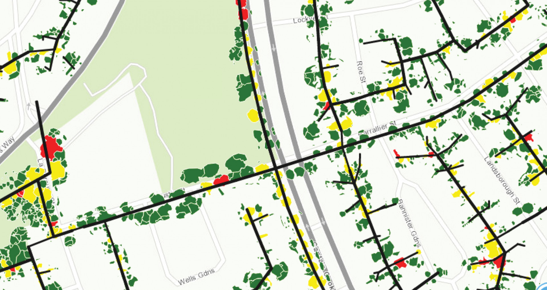 |
Digital Twin Confirm and correct multiple sources of data. LiDAR Analyzer generates a GIS-based vegetation digital twin of your network area. This digital model calculates line clearances and identifies fall in and grow in risks automatically. |
||
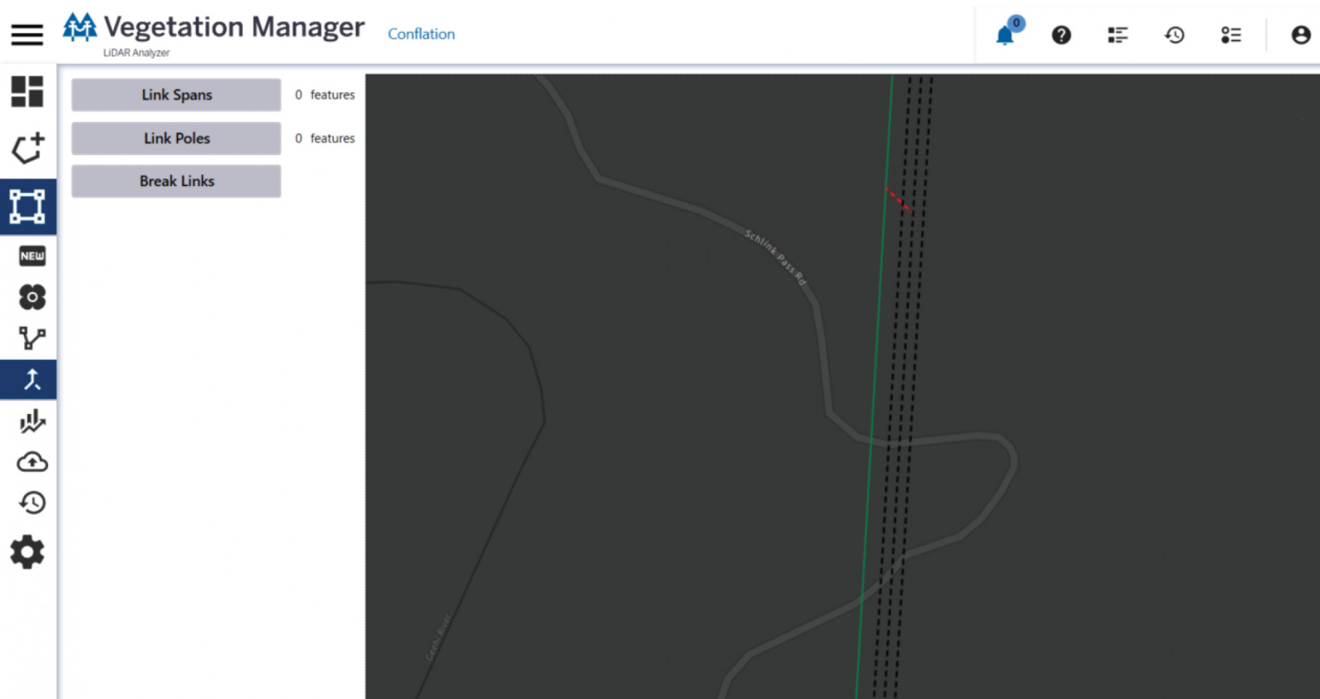 |
Update asset data Update your asset information with corrected spatial information ensuring that you have the most accurate information on structure locations to bring into your GIS. Robust workflows match to your asset information within the software. |
||
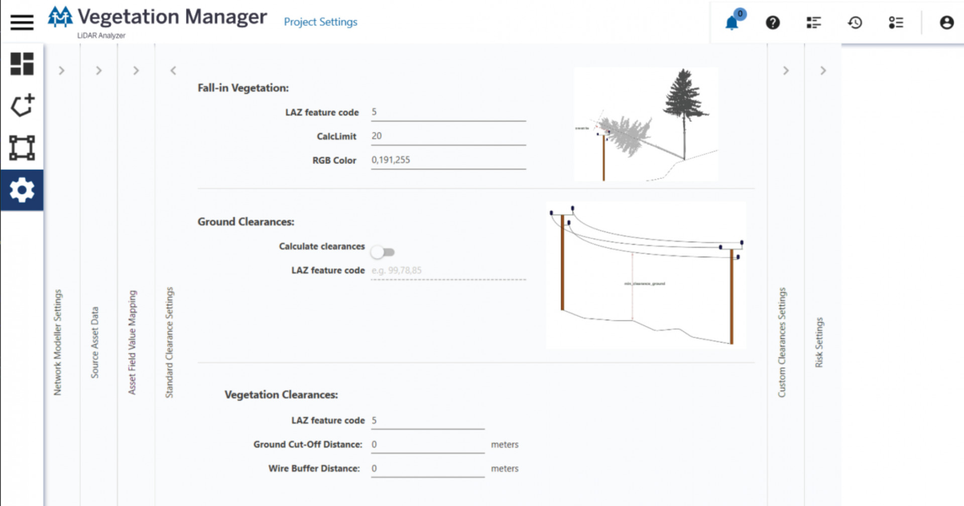 |
Take control Highly configurable software lets you set up clearances to your regulatory environment and use data from any LiDAR provider. Bring the tools in-house so you can drive efficiencies and get best value for your utility operations. |