New analysis delivers further value from existing LiDAR data for major US client
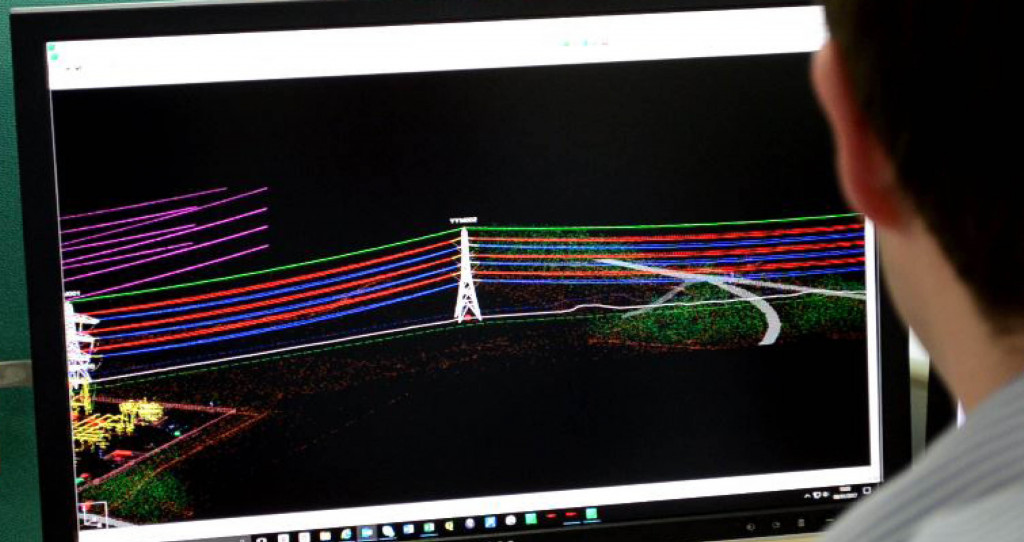
We have recently completed additional processing work for an existing US client. Captured during a previous aerial survey project, the data has now been modelled in PLS-CADD™ and delivered alongside high resolution imagery, topographic vectors and a digital terrain model for the area.
Exploiting more information from the LiDAR dataset enables further benefits to the utility and helps to ensure the maximum value is delivered. This project demonstrates how data can continue to have a practical benefit to the organisation, even years after being acquired.
View our services to learn more about the versatility of a geospatial approach to optimising power line operations.