Introducing Caydence™ Mobile – Network Intelligence Anywhere
NM Group is excited to announce the launch of Caydence™ Mobile, the latest enhancement to our Caydence™ platform. This new feature extends the power of NM Group’s geospatial and engineering insights to mobile devices, enabling utilities to access accurate network intelligence anywhere, anytime.
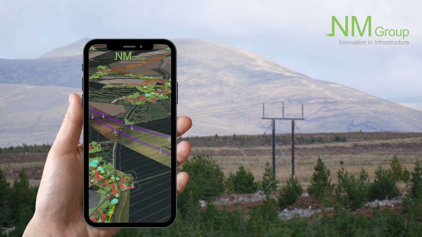
Caydence™ Mobile brings network intelligence directly into the hands of field teams.
A Seamless Mobile Experience
Caydence™ Mobile provides instant access to GIS, LiDAR, and asset data directly through a secure mobile browser – with no installation, version management, or downtime required.
Asset and Vegetation Management Teams simply open a secure URL to view and interact with 3D network data, ensuring a fast, consistent, and reliable experience in the field.
This browser-based approach ensures automatic updates, reduces IT overhead, and removes traditional barriers to accessing essential network information on the go.
Key Design Principles
The introduction of Caydence™ Mobile reflects NM Group’s focus on simplifying access to complex network intelligence while maintaining accuracy and performance in all environments.
Guided by the principles of accessibility, speed, and data consistency, the new feature allows office and field teams to collaborate using the same, up-to-date network view, supporting safer and more efficient decision-making.
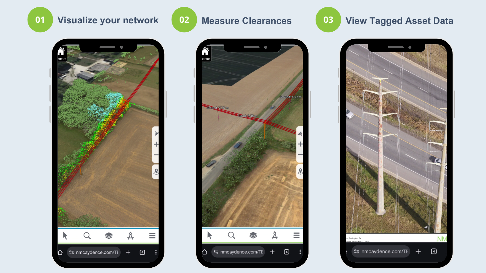
Explore Caydence™ Mobile in action – visualize your network, measure clearances, and access tagged asset data directly from your browser.
Feature Highlights
-
Instant access to network intelligence – View GIS and asset data with detailed analysis to support fast, informed decision-making, including conductor clearances, vegetation encroachment, and asset inventory.
-
3D visualization of LiDAR and imagery data – Assess field conditions and asset relationships in full visual context.
-
Real-time collaboration – Keep field and office teams aligned through a shared, accurate network view, with shareable, location-specific links to direct teams in the field.
-
Zero installation – Access data instantly via a secure browser, with automatic updates and no setup required.
-
Enhanced situational awareness – Identify asset conditions and vegetation risks, and plan responses quickly with precise, location-based insights.
Together, these capabilities make Caydence™ Mobile a powerful extension of the Caydence™ platform.
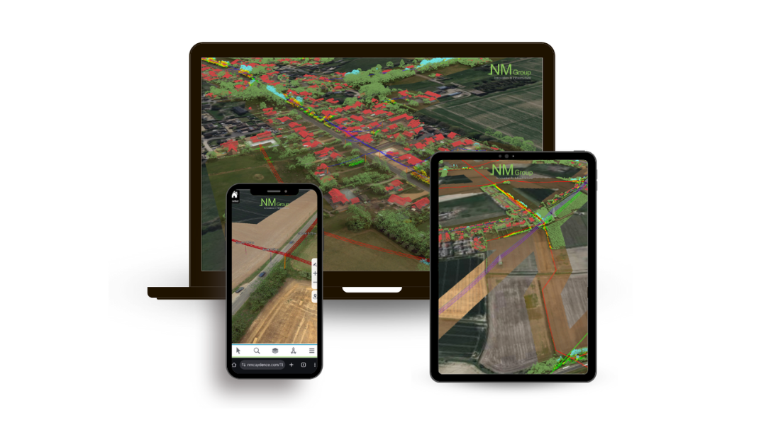
Caydence™ Mobile provides a seamless experience across desktop and mobile devices.
Caydence™ Mobile brings advanced geospatial and engineering insight directly to the field, enabling smarter, data-driven operations and improved decision-making – all with the flexibility to work seamlessly from any location.