Caydence software delivers 3D visualization for a Southern transmission network operator
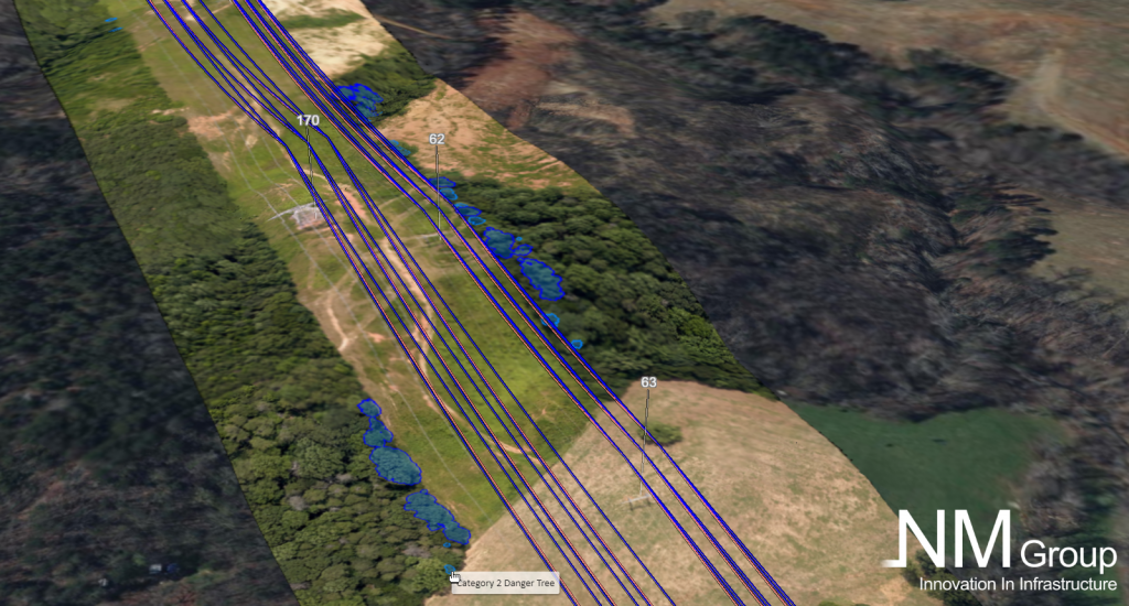
We're pleased to share that our Caydence software is actively supporting the operations of one of the largest utilities in the USA. Caydence is a cloud-based online platform. It simplifies the process of accessing and interacting with geospatial data, including LiDAR and orthophotography, offering a 3D visualization of the transmission network.
Key Benefits:
- Effortless Data Access: Caydence is a responsive and intuitive tool to access and interact with 3D data of the assets and their right of way, enabling a straightforward exploration of the network and surroundings.
- Rich Asset Insights: Our software lets clients easily view multiple layers of asset data analysis, promoting a better understanding of their infrastructure and surroundings.
- Informed Decision-Making: Caydence empowers users to make quicker and better-informed decisions.
Caydence seamlessly integrates with the existing data and analysis we've completed for a recent project, providing a clear view of our client’s assets and surrounding environment. This integration enables the visualization of critical reports, including circuit vegetation infringement status. This helps to better understand the remote sensing data and contributes to quicker operational decisions.
Accessible via the cloud, our 3D visualization platform enhances flexibility and significantly reduces the need for on-site visits. This accessibility aligns seamlessly with our client’s commitment to efficient network management and safer field operations.
Find out more about Caydence here.