LiDAR analysis helps to target vegetation risk for Canadian utility
We have been awarded a new project to help reduce vegetation related risk using LiDAR analytics. NM Group will work with the Canadian network operator to provide risk priority reports, tree height maps and OHL clearance data. This will be used to better instruct vegetation cutting activity and remove any critical threats.
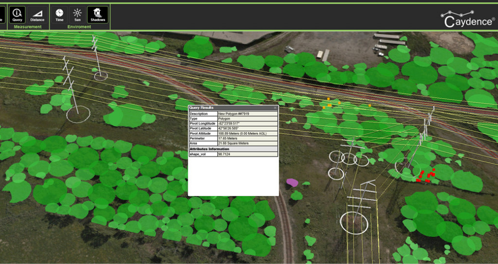
We will also provide tree canopy polygons using our segmentation process. This identifies individual tree canopy and tree stands and creates GIS ready data. The polygons are poplulated with vegetation data such as height, volume, predominant species or indicators of tree health. This approach allows cutting crews more precise information, quantifying the amout of work required.