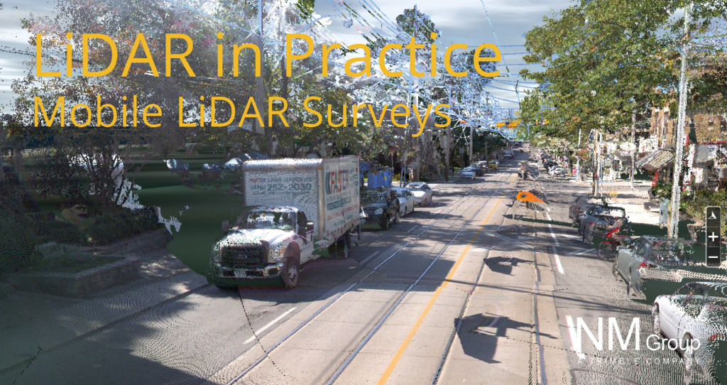
LiDAR technology in practice - Mobile LiDAR survey
In this blog series we are talking about, yes you guessed it… LiDAR. It’s one of the principle remote sensing technologies that we use at NM Group so its worthy of some explanation. In this four-part series I will be covering the basics of what it is, common uses of the data and some of the different methods used to acquire the data. In this blog we look at Mobile LiDAR survey…
So what actually is LiDAR data?
First let’s deal with the jargon, it’s an acronym that stands for Light Detection and Ranging. It is a remote sensing method, that uses laser pulses to scan the surface of the ground and other objects to obtain very accurate survey measurements.
What is a mobile LiDAR survey?
Mobile Mapping based LiDAR is the process of collecting geospatial data from a mobile vehicle. This could be a truck, car, ATV or boat. The common factor is that all options involve collecting spatial data from a moving and non-airborne platform. Typically, this data is in the form of a combined LiDAR and image sensor. When compared to aerial systems there are two stand out differences. Firstly, the density of the data (it is incredibly dense) and secondly, perspective. Driving alongside the terrain means you get a horizontal perspective rather than a vertical (as per airborne LiDAR).
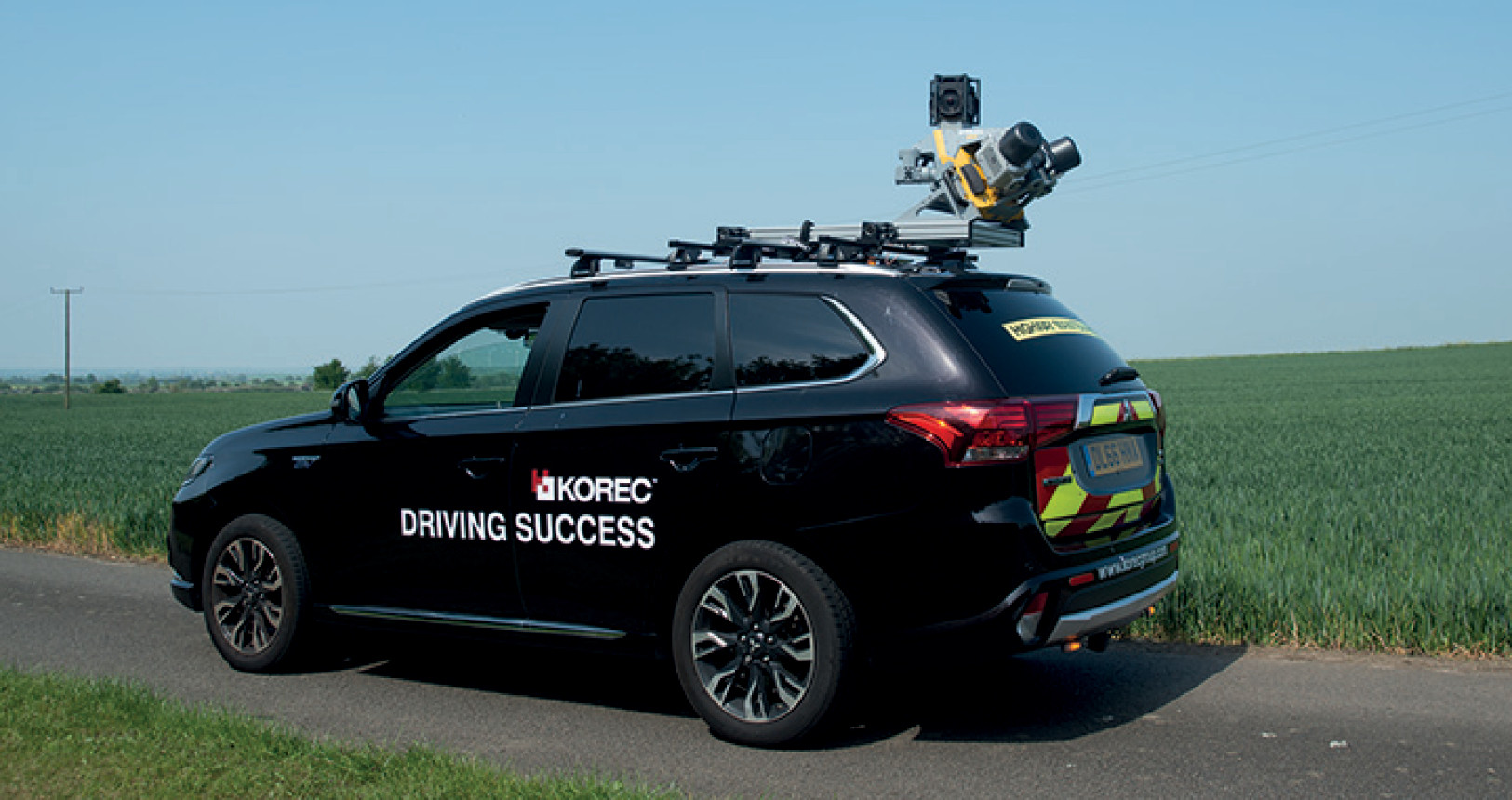
A Trimble MX9 Mobile LiDAR system – image courtesy of KOREC
What are the benefits?
- Density of data – mobile mapping systems get very dense data sets. This means a high degree of precision and detail.
- Safety – system operators can work inside the vehicle. Avoiding potential hazardous locations such as working along a road or track side.
- Efficient data capture – in the right environment, driving a vehicle fitted with survey equipment is a low cost and efficient way to collect spatial data.
- Accuracy – with the right control, laser scanning from mobile mapping can produce data with a very high accuracy
What are the applications?
Mobile LiDAR surveys are an ideal platform for asset management and maintenance surveys of linear infrastructure. Good applications include surveying highways or railway networks. Also in urban areas this can be a very cost effective method of capturing power networks.
Being vehicle based, surveys can be affected by challenging terrain. This can make capture slower, but as always the suitability will depend on the specific environment of the area of interest. Other road users and street furniture can obscure the line of sight and cause data shadowing. However driving in the opposite direction can be used to mitigate this issue.