Mobile Mapping an urban distribution network
Managing vegetation around networks represents a significant expense. Identifying what vegetation poses a risk and then prioritising subsequent tree cutting. To prevent outages and maintain a reliable service, utilities have a regulatory requirement to inspect their system for vegetation infringements. Remote sensing techniques like LiDAR have been shown as an excellent way to map the network environment in 3D. When combined with geospatial processing techniques this allows a variety of vegetation reporting products to be created, helping target vegetation management activity.
We recently conducted a project in Canada, studying a risk-based approach to vegetation management, to enable more cost effective cutting on a distribution network. The network was heavily urbanised with a lot of underbuild on the circuits. A key part of the pre-project discussion revolved around how to acquire the data in the most effective manner. A number of data capture techniques were considered; Aerial LiDAR, Mobile LiDAR, satellite imagery or even a hybrid approach. Following a discussion with our client, we chose Mobile LiDAR to suit the exclusively urban environment we would be working in and in order to acquire a detailed picture of the underbuild (of particular interest to the client). A comprehensive understanding of the client’s network and the unique requirements for the project are vital in selecting the best method for obtaining asset data.
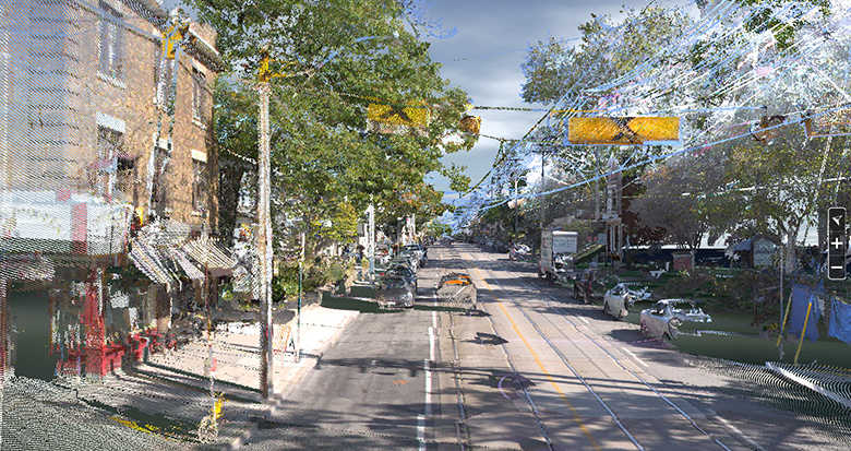
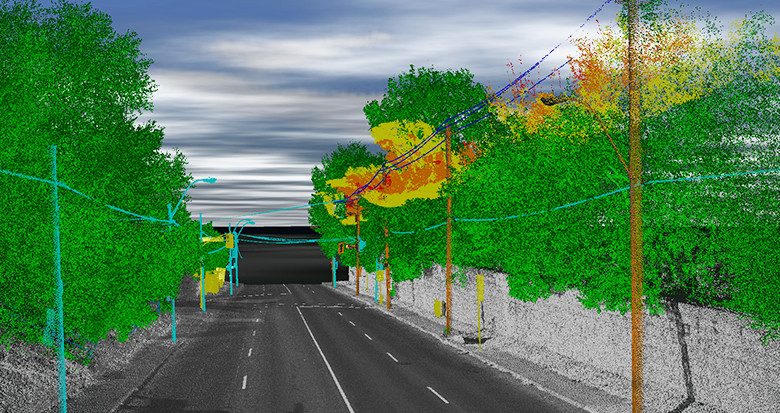
Having decided on the mobile LiDAR approach, the project captured 30 km of distribution network, ranging from 2.4 kV upwards. Driving a mobile system along the street routes, we were able to efficiently capture the power line assets and acquire highly detailed 3D data.
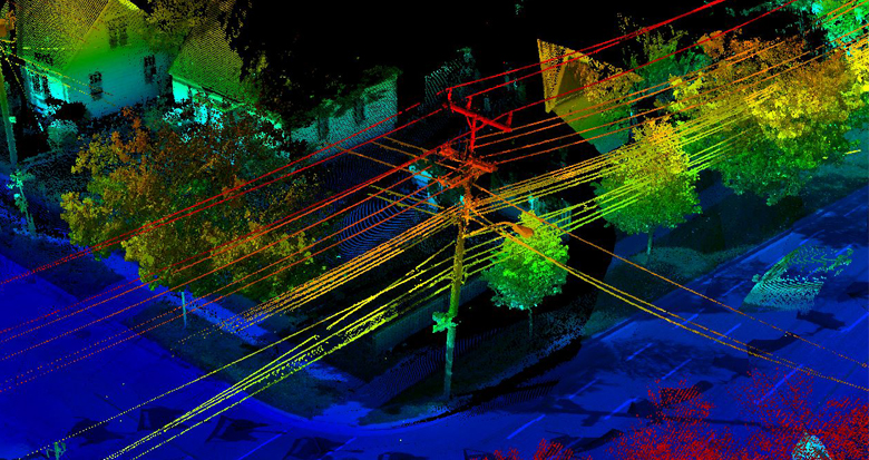
We created GIS data to update the utility’s records and in-house Vegetation Analytics were used to rapidly identify the location of all vegetation clearance issues. To do this we processed the geospatial data into a 3D CAD model, and then modelled our client’s specific regulatory cutting zone around the powerline (see image below).

What is Mobile LiDAR Survey?
Mobile Mapping uses a LiDAR scanner mounted to a moving vehicle, providing 3D measurements from the field. The system can normally be mounted to client vehicles making them ideally suited to supplement existing inspections and patrols. The 360° coverage from the data makes them perfect for asset management and inspection activities in an urban environment
3D snapshot of the network, highlighting the complex underbuild on the network
Project outcome
The project highlighted some of the benefits of using geospatial data for a utility. In this case, there was an increased ability to identify vegetation grow-in infringements (our testing shows this to be better than 99% accurate). This helped facilitate the prioritisation of remedial action, improving the system reliability.
Secondly this data could be used for objective scoping for cutting contractors, ensuring a more targeted approach as opposed to ‘patrol and cut’. This will eliminate unnecessary cutting of vegetation. A secondary benefit is that future data surveys would highlight the effectiveness of the tree cutting, ensuring contractor accountability.
This project also demonstrated how choosing the right method for acquiring the data is key. In this scenario, mobile LiDAR survey proved an excellent option in the data capture tool-kit.
Find out more about our vegetation management service.