Five Common Utility Questions - Part 3
Here is a third set of common questions power utilities ask us when discussing LiDAR projects. Read on to find out the most frequently asked questions and what you really need to know to get the best possible project outcome - missed my first client FAQ blog.
Is aerial LiDAR the best method to capture powerline data?
This question is often posed as: “Is one method of collecting LiDAR data superior to another?” Spoiler alert: There is not a one-size-fits-all solution. Sometimes a particular method is the clear choice, and other times there are a number of options that could work. Additionally, as sensor technology progresses, it is being rapidly scaled down in size, and can therefore be used in a variety of ways that were impractical even a few years ago.
The truth is that clearly understanding the network (how dispersed it is and the environment in which it exists) is the most crucial aspect when selecting a survey approach. Once that is established, it is best to design a methodology from basic principles up; whether that is aerial capture, mobile or a mixture of several platforms. A key part of what we do is working closely with our clients and forming a deeper understanding before recommending an option. Increasingly, a hybrid approach using multiple platforms is becoming the norm.

Can you check pole rot during an aerial survey?
One of the key challenges for our industry is in how to collect more asset condition and positional data for operators. Much is currently possible; office based inspections looking at the condition of assets using imagery, video, infrared sensors, corona inspections and LiDAR.
Using geospatial analysis, it is even possible to determine the degree of pole lean and cross arm deviation. This enables the detection of many serious reliability defects. However, to my knowledge, there doesn’t yet exist a direct replacement for ground checks to determine pole rot. That being said, technology doesn’t stand still and I look forward to a remote sensing solution for this.
Can LiDAR provide vegetation data for individual trees?
We are asked this all the time when visiting vegetation managers. Typically, there is a real interest in how much data we can provide on the corridor or RoW, as well as anything that can help estimate or drive down the cost of tree management activity. We are getting more specific questions about estimating tree numbers and providing other metrics.
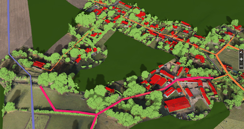
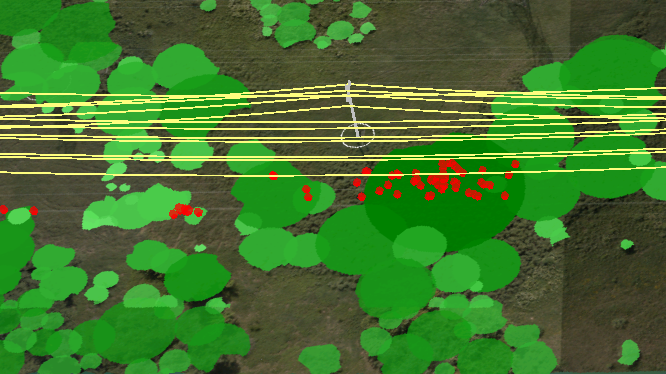
Some really interesting data analyzes can be provided using LiDAR and imagery data, including breaking down the data to isolate tree canopies. This is becoming more and more sophisticated, and with LiDAR and imagery it is possible to get very good results for a circuit or network. Each tree canopy object can also be attributed with further data to help tree managers and contractors. This includes the area, volume of vegetation, height above ground and predominant species type. It is even possible, using 4 band imagery, to infer tree health using NDVI analysis.
So there are some really clever smarts out there. Not just locating where trees are too close to powerlines, but providing a host of information to inform cutting practice.
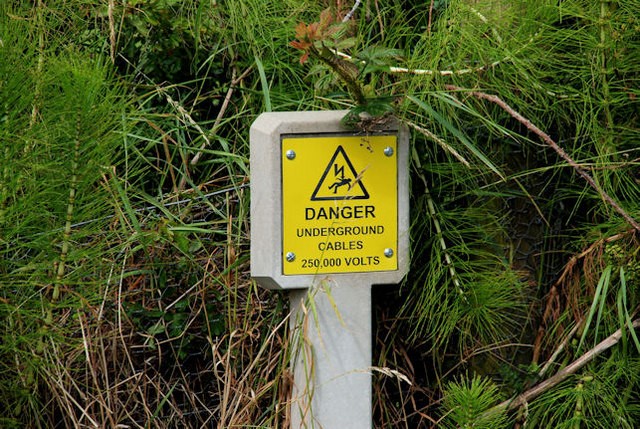
Can you detect underground cables from the air?
Another question that we get asked quite often is: “Can you detect underground cables using LiDAR technology?” LiDAR uses laser pulses of light to collect detailed measurements of the survey area. Because light uses line of sight, anything that cannot be seen (such as undergrounded cables) is not able to be surveyed with LiDAR.
That being said, one element which can be detected with LiDAR, is the profile of the ground, and changes in topography (such as from subsidence). Understanding how the environment changes along a network also has a lot of other benefits, such as recording new engineering work, looking for unauthorized buildings along the network and monitoring growth rates of vegetation.
How much of a network can you aerially capture in one day?
Aerial capture is (due to the fact it uses relatively fast moving aircraft) a rapid process and it is much quicker to fly hundreds of miles of network than it is to patrol by foot.
The actual rate will depend on the kind of data sensors being used and the project requirements. If you need to fly close to the ground you will make slower progress, whereas if you can fly higher you can normally capture data much more quickly. The network itself must also be considered. Flying long straight sections of transmission network is a completely different prospect to a condensed distribution network in an urban area.
The other key aspect to consider alongside aerial capture is the processing time for the data. It’s all very well capturing a network in a day, but the data must be translated into a meaningful format in order to make it useful.