Enhancing existing patrols with remote sensing technology
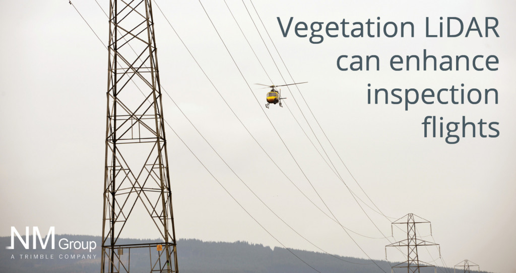
Many electricity utilities operate a scheduled program of helicopter flights, to regularly inspect their network. These patrols represent a significant investment, as multiple flight regimes are often required for different types of line inspection. NM Group have pioneered an approach to let utilities acquire LiDAR data whenever they fly their existing patrols. This has the advantage of enabling vegetation risk reporting and high-resolution images to be captured without compromising the original patrol objective – providing crucial compliance reporting more network information without the time and cost of an additional aerial flight.
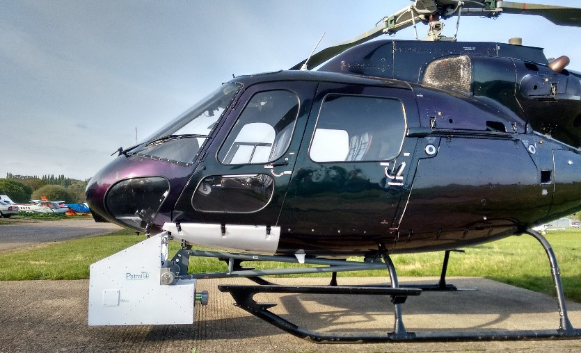
Patrol+®
Created by NM Group, this new approach, Patrol+®, combines the latest sensor technology with intelligent processing workflows. An aerial patrol is flown as normal, while customized sensor hardware and proprietary software compile the 3D and image data ready for analysis. Upon completing a flight, the field data is processed through the cloud into risk maps, reports and a 3D asset register made from the LiDAR data.
Patrol+® provides a clear path to defendable regulatory compliance. It is used to increase reliability and safety through the quantification of vegetation risk. The installation of Patrol+® technology on existing patrol flights enables access to LiDAR technology at low marginal cost
Practical examples
The Patrol+® service has been successfully applied to existing patrols in New York State, Florida and Kentucky, totalling over 10,000 miles. These projects prove that by leveraging the existing helicopter flights, much more information can be gathered to help manage the network efficiently. This can take the form of detailed asset defect reporting or accurate vegetation risk analysis derived from the analyzed LiDAR data. Utilities have benefited from a library of georeferenced structure images, high-resolution video and accurate identification of grow-in and fall-in trees.
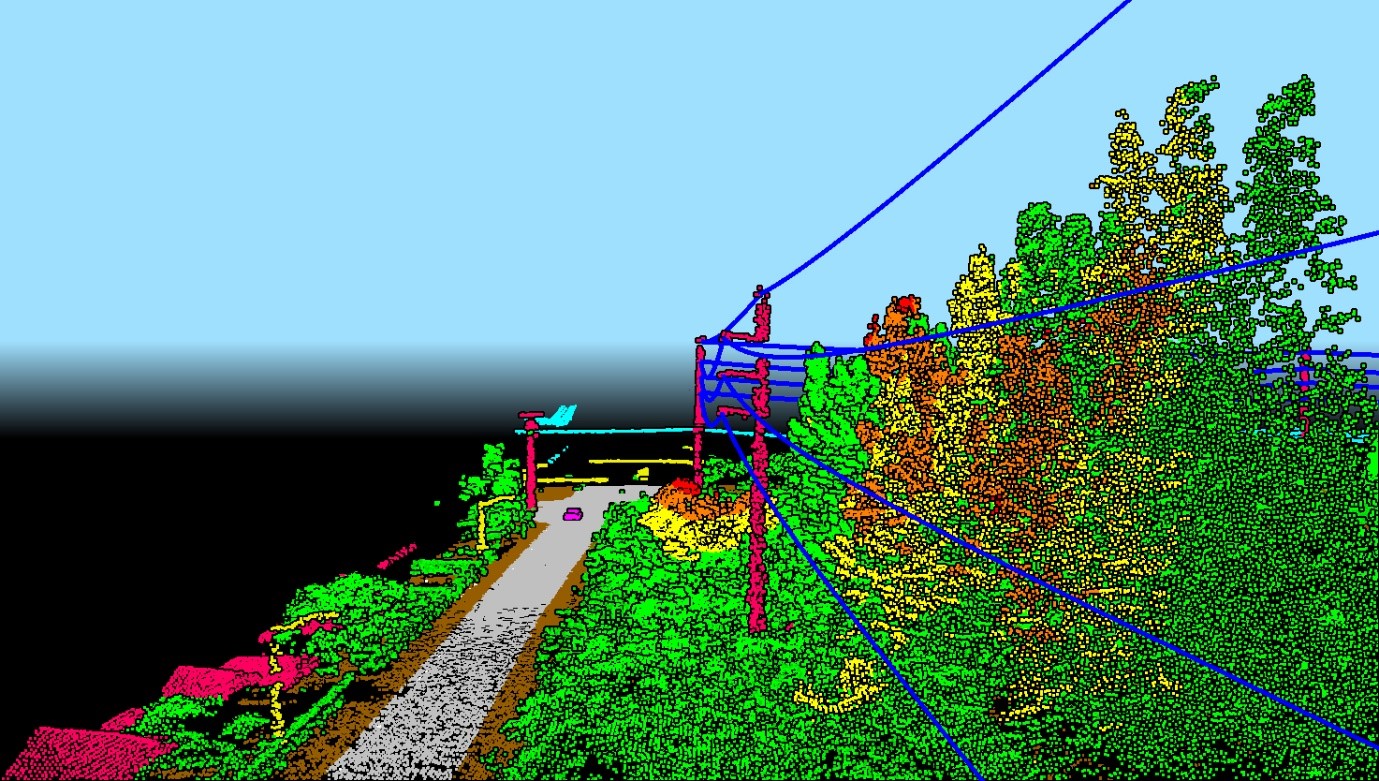
Close up data from a Patrol+® supplemented helicopter flight
“Utility companies and vegetation managers are constantly looking for opportunities to leverage every OPEX & CAPEX dollar. NM Group’s Patrol+® provides utility asset managers with additional options to leverage their planned patrols by obtaining asset condition data”.
Bertram Stewart, Vegetation Strategy Manager at National Grid
Technology
The Patrol+® concept uses aerial LiDAR scanning technology to acquire thousands of precise measurements of power line assets, the ground surface and vegetation. This technology was crucial in understanding the relationship between the powerline assets and the potential vegetation risks and enabled very accurate clearance analysis.
Caydence®, our asset management platform displays the utility network in 3D creating a virtual environment for displaying the vegetation and asset defect reporting. This tool provides improved access to the field data, helping direct management activity more efficiently as well as improving utility collaboration.
Summary
Through innovative new processing and technology advances, both inspection data and vegetation management reports can be reported from a single operational flight.
LiDAR analysis means the objectivity and accuracy of the vegetation scoping and audit can be greatly improved on over visual methods
Using remote sensing for collecting asset and vegetation data means that a robust audit trail is established, demonstrating regulatory compliance and reducing legal and financial risk