Geospatial data and CAD analysis will remove network constraints for UK DNO
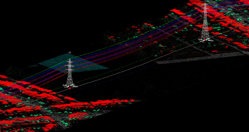
We are delighted to announce a new engineering project for a major UK distribution network operator. 160 km of 132 kV overhead lines will be aerially surveyed to capture LiDAR and high resolution imagery. The geospatial data will be modeled in the CAD environment to determine the maximum rated temperature, as well as to locate any thermal constraints. Our experienced powerline engineers will then assess the relative merits of all the viable options to recommend the best mitigation approach.
A thorough analysis will include options such as conductor re-tensioning, suspension clamp offsets or removal of ground material. We can also consider re-conductoring or steelwork modification to see if that presents best value. All options and our recommendation will be delivered in our clients engineering report.
Find out more about NM Group’s up rating service.