The Power of Mapping - GIS for electricity networks
Geographic Information Systems (GIS) allow the user to visualize, question, and interpret data to understand relationships, patterns, and trends. GIS-based maps and visualizations provide contextual tools for mapping and spatial reasoning, making it possible to explore data and share location-based insights. When considered in the perspective of the power industry and in particular electrical networks, GIS has a number of valuable applications.
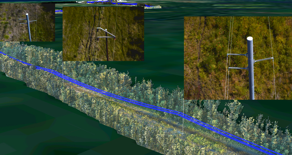
Success for a power network depends on accurately understanding the position of its assets. Parts of some networks are more than a century old, making it difficult to be certain of the exact location of each tower and pole purely from using the archived design records. The accuracy of old records can be further reduced for areas of network that are remote or hard to reach. Asset management and maintenance is a major challenge facing network operators, and reliable location data is vitally important given the monetary and operational value associated to these assets.
Consequently, GIS has become a crucial tool for understanding the position of these expensive assets, their environment and how to access them in the field. It supports the establishment of an asset inventory, linking high value objects to their location and supporting better management practices.
GIS offers a number of opportunities to further improve performance and operations within power utilities, such as:
- Improving the record of the position and attribution of assets to get a good baseline and to deal with change
- Linking more information to the GIS, such as photos of the assets or the details from the asset system
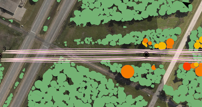
- Deriving more layers from the data being used to map those networks – such as vegetation layers and terrain from LiDAR
- Ensuring the GIS data gets out to users via tools such as lightweight web portals
- Turning things 3D – enabling measurement between GIS objects to improve decision making