Why network operators are going 3D – Part 2
By Shane Brunker – NM Group Technical Director
In this new three part blog series we look at why electricity network operators are considering and indeed implementing 3D visualization platforms as part of normal operations.
In the last blog we discussed the main reasons utilities are moving towards 3D. In summary, it is because 3D enables intuitive access to detailed asset information in an “app” format, the necessary technology is now widely available and because the capabilities are truly powerful and practical. In Part 2, we will be looking at some utility case studies.
Scottish and Southern Electricity Networks vegetation risk reduction
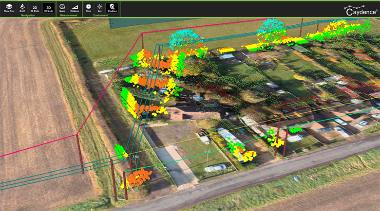
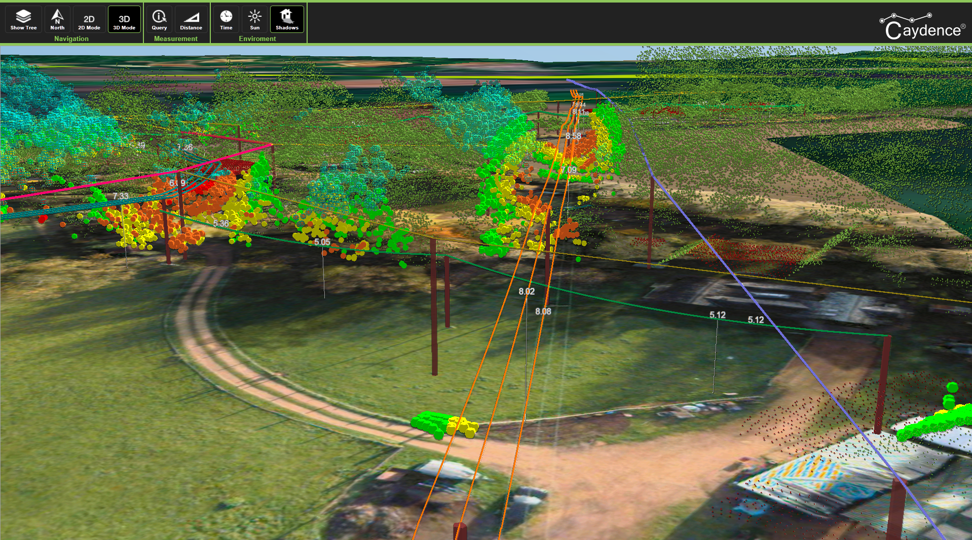
With 63,000 km of overhead line, Scottish and Southern Electricity Networks (SSEN) are using remote sensing data to pinpoint trees and vegetation which could pose a risk to their network and result in outages. All data and the prioritized risks are being presented in an online 3D system.
SSEN will use the 3D environment to conduct a ‘virtual assessment’ of the risks that were identified in the analysis. This enables vegetation managers to confirm high priority defects, determine how much work will be needed and then issue a fully informed tree cutting instruction.
Additionally, creating the comprehensive 3D network environment helps SSEN to plan future assets. The detail and the context provided by the mapping will be used to create efficiencies in the design stage, which SSEN believe should reduce the cost and completion times for new connections.
SSEN network assets presented in 3D ready for scoping and vegetation cutting
Strategic efficiencies within major Canadian transmission utility
Another great example of 3D data implementation can be found on a project we are undertaking with a major Canadian transmission utility. Tasked with maintaining a vast and highly dispersed network, there is a significant appetite to find new ways of improving operational performance. To achieve this aim, we are helping the customer to explore how network LiDAR and imaging can be used to provide benefits to multiple groups and make work more accurate and efficient.
In this instance, a 3D environment provides a more accessible method to share data with several organizational areas, including engineering, asset management and vegetation management. 3D enables effective collaboration and is a universal platform for bridging the gap between specific engineering software, corporate systems and softcopy reports. The expected benefits are both better decision making and more efficient working practices.
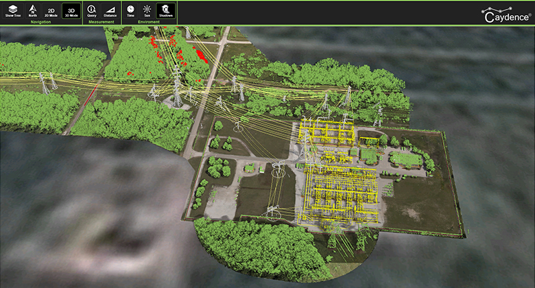
3D transmission network data in a ubiquitous and widely available online environment
To summarize…
In both these case studies the use of 3D is helping utilities to understand their networks and carry out work planning in a more holistic manner. Far from being a short term trend, the spatial presentation of asset data is empowering the utility workforce with critical information and the ability to conduct ‘desktop site visits’.
As both examples show, the ability to easily and quickly understand (and what better way than via an exact 3D replica of the network) assets and the environmental context in which they are located leads to more informed decision making. Better decisions ultimately lead to improved network performance, improved reliability and lower operating costs.
In part 3 we will look at some of the key areas to consider when accessing a choice of 3D platform…