Rapid Vegetation Reports
Our rapid vegetation service enables network operators to get fast results on critical vegetation infringements. After a project flight, we can report any clear violations to a utility. Then within 2-4 weeks, we provide a clearance report for each circuit. This doesn’t rely on full-scale CADD modeling to determine how close vegetation is to the wires. Which, although highly accurate, requires a more complex production process to deliver its results, taking longer.
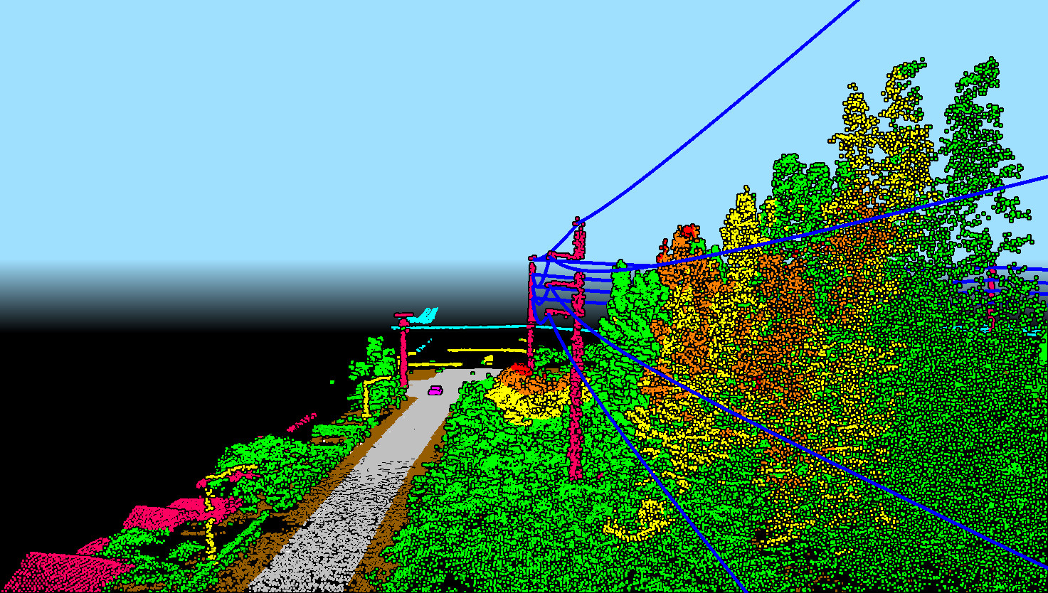
By using our rapid vegetation approach we extract the wire and vegetation position at time-of-survey. Then combine the data with a clearance distance buffer to report on any vegetation too close to the OHL. Clearance distances are determined in advance with the utility, typically prioritized using a red, yellow and green risk status. Each clearance distance can be fully customized to meet a utilities regulatory and internal policy requirements.
Key benefits
- Rapid delivery of vegetation reporting - significantly faster than traditional LiDAR-based analysis
- Prioritize cutting by targeting the worst-case encroachments and ensure compliance
- Accurate to within 8 cm absolute (< 3 cm relative)
- Avoid false positives by being able to ‘see’ risks using a 3D web viewing platform
What do you get?
- Post-flight any critical vegetation risks observed in the data reported immediately to project team
- 2-4 weeks post-survey a vegetation analysis delivered via online portal showing vegetation risk by priority status
- 4-8 weeks post-survey a final report showing all minimum clearances for each span
Reporting formats can also be provided in excel, pdf and GIS compatible outputs