3 important reasons to start using LiDAR for your vegetation management program
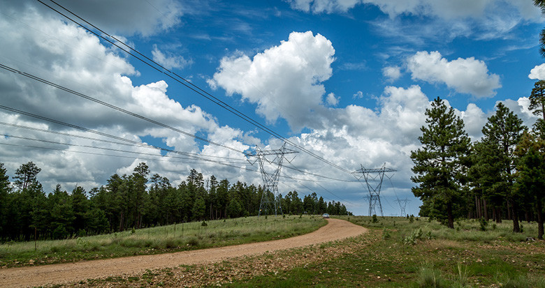
Spring is here and that means trees are growing. Spring flush typically starts in April and for Utility Vegetation Managers we know that means planning for the year’s tree management activities. So it seemed the ideal time to discuss planning and scoping strategies to help you get the most out of your vegetation management operations.
Common methods of analyzing tree risk on your network
Walking the line and checking for vegetation encroachments works. It’s been a tried and tested method for many years. You can also cut as you go, avoiding any delay in managing tree risk. Rather than relying on foot patrols, you could also use helicopter patrols. This is much quicker and helps collect data ahead of a dedicated tree cutting program. But how can you be confident in spotting the worst risks and avoid wasting resources on false positives?
Three reasons to use a LiDAR based approach
Then there is LiDAR based vegetation reporting. LiDAR provides all the advantages of an aerial patrol, but crucially delivers precise reporting on exactly where on the network trees present a risk.
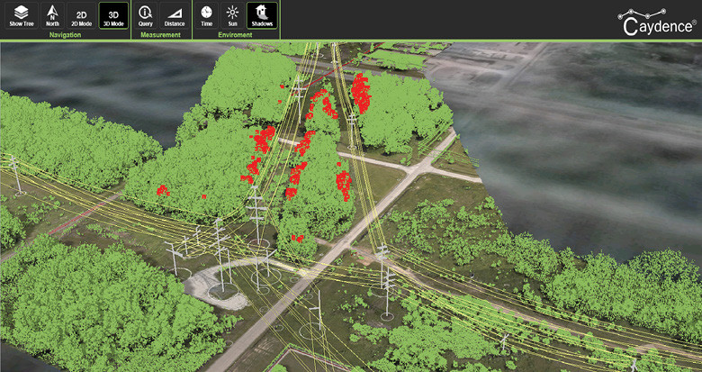
Example vegetation LiDAR reporting for a transmission network
1. Clear cutting priorities
LiDAR reports allow you to calculate the exact distance from every tree to the OHL, ranked by network priority. Combine clearance distance with grow-in and fall-in risk, voltage level, network connectivity or tree type and you can create a much more targeted scope for cutting.
2. Cost saving
Using these reports means you don’t need to patrol or cut areas with no or low risk and prevents you missing any critical risks. You can reduce budget spent patrolling unnecessary areas and avoid the outage or regulatory costs of missing a critical threat.
3. Audit tool
Lastly, LiDAR is a great tool for demonstrating your network management to an external regulator. For compliance and audit purposes, the technology creates a snap-shot of the network.
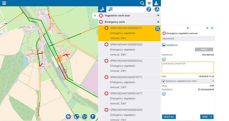
An example of a work management tool using LiDAR risk data
Conclusion
Vegetation LiDAR reports provide clear, analysis of where to target your cutting. With the right analysis and implementation, the data can be used to inform cutting operations. We believe the advantages and potential cost savings make a persuasive argument for using the technology.