A question of perception: Vegetation hazards to overhead powerlines
By Sophie Davison – KTP associate
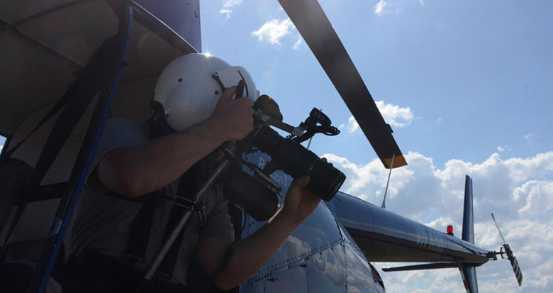
After many discussions surrounding testing the advantages of LiDAR surveys for identifying vegetation risks to overhead power lines with my Knowledge Transfer Partnership (KTP) supervisors at Durham University and NM Group, I found myself carefully editing video clips of aerial video of helicopter patrol flights. I wanted to create a hazard perception test that would help understand how difficult it is to identify vegetation risks visually from an aerial perspective.
In the months that followed I asked over 50 people, including colleagues at NM Group, postgraduate students at Durham University and (when I could persuade them!) friends, to take the vegetation risk perception test. Participants would watch a short video clip captured from a vegetation inspection flight of a high voltage powerline and carefully click where they thought a fall-in and grow-in vegetation hazard existed. In the interest of fairness I ensured all those taking the test had a thorough run-down of what these concepts were and had some initial practice.
The ‘hazards’ clicked on were then compared to genuine hazards identified using a fully georeferenced LiDAR dataset with 3D clearances generated from a detailed engineering model of the powerline. Aside from exposing colleagues to vegetation management concepts in an interactive way it also threw up some interesting conclusions.
There was a huge spread of abilities that surprisingly weren’t linked to previous knowledge of powerline engineering concepts or vegetation management. However, there were also some general trends:
• Fall-in hazards were easier to identify than grow-in hazards, but on average the proportion of correctly identified hazards for both was still below 15%.
• All participants identified a large amount of false positives where they incorrectly thought a hazard was present.
• The greater the surrounding tree cover the greater the number of false positives and real hazards missed.
Even though this exercise was based on video footage instead of a real-time ‘in the air’ inspection, it does show just how difficult it can be to conceptualize the clearance envelope and judge fall-in tree trajectories from an aerial perspective.
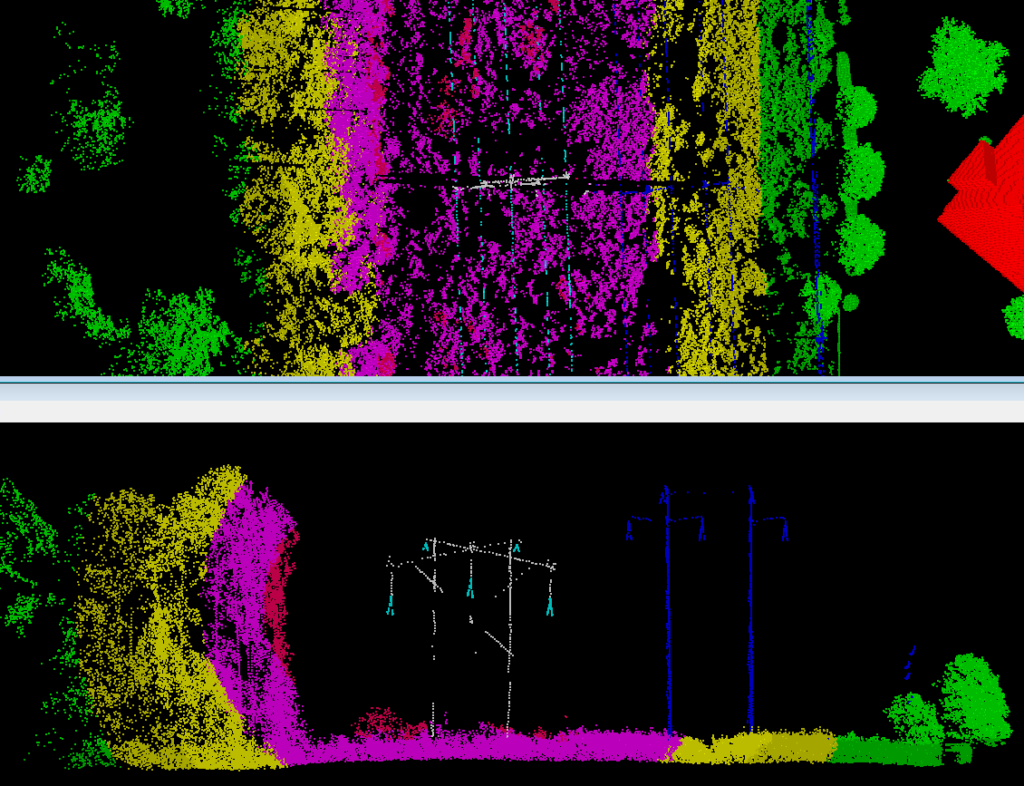
Plan and profile of a powerline corridor produced from remote sensing data adds precision to conductor clearance measurements
Nearly all participants gave feedback that the perspective made it tricky to judge 3D distances and heights, despite slower than real-time video and often being able to view wires and hazards from multiple angles. Quick fly-by vegetation inspections in the field are fast and cost effective but, as this highlights, could be highly susceptible to human error and false positives. Remote sensing techniques, such as LiDAR survey, remove the subjective aspect and bring an accuracy and precision to vegetation risk detection that can’t be beaten.