Predicting where snow load on trees could impact the network
Trees or other tall vegetation that touches or falls into a powerline can cause a phase to earth fault. This disrupts the regular supply of power, and causes reliability issues for companies and customers. Standing trees that wouldn't normally make contact with a powerline could be made to bend and make contact under heavy snow loading. The extra weight on branches can bring the tree into contact with the powerline. This event is often very difficult to detect as when the tree connects the electrical contact can cause the snow to melt, leaving the tree to spring back under the reduced weight, leaving little or no trace beyond the outage.
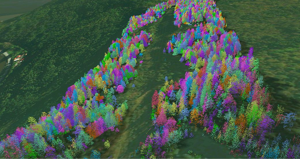 Using geospatial data to segment the data into individual tree canopies
How can geospatial analysis help?
NM Group have pioneered a set of highly functional analytics for helping utilities optimize vegetation management. Until now, these have mainly been focused on growth rates and tree fall likelihood on the network. Following discussions with networks in Northern Europe we have been testing our fall-in likelihood model with additional variables for assessing snow load on trees.
We can segment the LiDAR point cloud of a forest surrounding overhead lines to create an inventory of tree geospatial objects and understand which of these trees has the capacity to make contact with the powerline when bending. In a recent example we worked through 81,000 trees segmented from a sample point cloud covering a 25km test section of powerline. 760 trees had the potential to make contact with the powerline when bending. Although interesting this is probably unhelpful to a utility that needs to target scare resources in the most effective way possible. This requires further analysis.
To further refine this we used existing research on tree structures most likely to bend due to snow loading. This considered the degree of bend before the tree would connect (those with comparatively small degrees of bend could be considered high risk). We also were able to identify those trees with structural characteristics that lend themselves to higher risk, such as the ratio of tree crown width to height, or a high center of gravity.
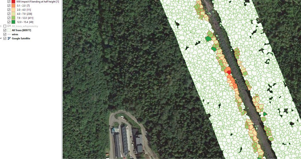 Example analysis showing how much a tree stem needs to bend before impacting on a line (red is relatively small degrees required)
What does this mean for network operators?
Modeling these variables within our Vegetation Analytics service means we can help utilities focus from the thousands of trees which have the potential to fall to just those that statistically have the highest risk. In addition, this approach uses localized data of a specific network to increase its accuracy. Therefore, it doesn’t need to rely on generalized models of tree types or environment.
For operators who are looking at a proactive approach to tree cutting, or with high levels of winter disruptions this data will arm them with the information needed to target in the most effective manner possible. We believe this kind of approach can be hugely beneficial to prevent the kinds of customer disruptions that have been experienced in Europe and the North America.