The future of utility vegetation risk modeling – Part 3

By Shane Brunker, Technical Director at NM Group
In Part 1, I explained the rationale for a new approach to vegetation risk modeling, driven by the way we can quantify and manage threats to a safe and reliable electrical network. In Part 2, I discussed the specific elements of the model in detail. In the final part of this blog series, I am looking at the way you might link the enabling technology to utility policy and to business process. This is important, because by implementing this approach despite some challenges, we believe significant benefits can be realized in cost and in reliability.
Policy / regulation
As relates to vegetation management, we typically see that the regulator states that powerlines must be inspected at a given interval and must be kept to local clearance requirements, in order to remain compliant. Utility policy typically reflects this, with ground or aerial patrols sitting alongside cutting contracts.
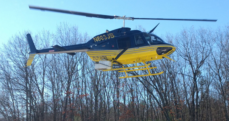
LiDAR capture to inform vegetation management operations
The remote sensing approach (usually LiDAR) is deployed within this policy framework – sometimes to provide a pre or post cut audit (for business intelligence), sometimes to ensure contractors manage critical areas and sometimes to enable prioritization of the contractors. Of course, there is wide variation between utilities, with some very advanced practices in place in some locations.
“Embracing a risk-based approach to vegetation management means changing policy and, potentially, changing regulation.”
This means accepting that:
- The entire system does not necessarily need to be inspected at arbitrary intervals;
- Clearance distances (and cut back) can and should vary across the network;
- Certain trees should be removed or retained, based on their risk profile;
- And that prioritization of works should be based on the likelihood x impact formula, in order to maximize the value of any money spent managing the vegetation. Not one size fits all
Division of responsibility
A change in policy (and if required, regulation) means that the organizational and contractual structures for discharging this work will change. In the future, I believe the industry is going to need to ask questions like:
- Who captures the remote sensing data? is it one or several providers? Is this something that the utility should manage or should it sit behind an analytics service?
- Where does responsibility lie for owning and managing the cloud storage that takes in the remote sensed data and analyzed results? The utility, the remote sensing provider, the analysis provider, or the vegetation contractor?
- Who is developing, controlling and implementing the analysis algorithms? Where is this analysis taking place and how do the findings get onto the cloud and into the utility systems?
- Where does responsibility lie for owning and managing the 3D portal that allows a more detailed assessment and the final scoping exercise to take place, based on the prioritized data? The utility or the vegetation contractor?
- How are the findings actually being actioned such that once risk is assessed a contractor can go out and do some work? Is this an integration with an internal Vegetation Management System (VMS) or is this discharged via the analysis / 3D visualization platform?
This effectively asks how you are going to organize the industry providers obtaining the data, analysis, work management systems and access platforms, and how much of the process they will manage (and conversely, how much will be managed within the utility).
Converting to contracts and business processes
It is clear that we have a range of activities, processes and parties involved in implementing a risk-based vegetation management approach. Stakeholders include the utility managers, vegetation contractors, data collection groups and analytics/systems providers.
- It is our view that an ideal model will have a singular vegetation management system and online 3D viewer controlled by the utility, which issues work in consistent formats, according to risk prioritization.
- Remote sensing data collected by one or more parties ought to be stored in a cloud that manages versioning, updates and inputs to analytics – not just a ‘dumb store’.
- Analytics, managed by a third party specialist, should be able to take in remote sensing data from multiple sources/providers, via this cloud environment, and run consistent modeling exercises to produce the risk-based scoping and prioritization.
- The above are then automatically fed into the linked online 3D viewing system and VMS, for immediate verification and to instruct a suite of contractors.
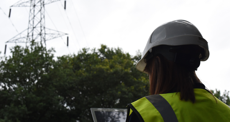
Contractor using 3D viewing system for verification in the field
Conclusion
To enable and get maximum value from risk-based vegetation management, change is required, in utility policy and in the way services are structured and procured. In my view of the future, utilities will demand a single-source viewing system and comprehensive VMS that links with (or forms part of) contractor systems. This will be fed by analytics generated on a cloud platform, which have been developed, in concert with the utility, to ensure compatibility to local conditions. The analytics provider ought to set the input criteria for remote sensing data, which they may sub-contract or receive via existing utility subcontractors. Work will then be issued to vegetation contractors via the internal VMS (and by the utility) on a consistent basis, under set rates that allows live feedback to improve overall visibility of progress and status.
It is not exactly a small challenge to implement this sort of change, but the benefits should be immense in terms of reliability, improved compliance, improved business intelligence and in cost reduction.